During my time at ATP, I wished there were a better way to visualize airspace beyond a flat sectional chart.
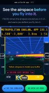
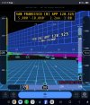
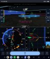
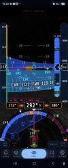
Toward the end of my training, I started developing Pilot3D, a free tool that visualizes airspace in 3D in real time.
The goal is to help pilots better understand where they are, what airspace they're in, and what's around them.
I've attached a screenshot to give you a look at what I've been working on. I'd love to hear feedback from fellow pilots, CFIs, and DPEs. What features would you find most useful?