BravoHotel
Well-Known Member
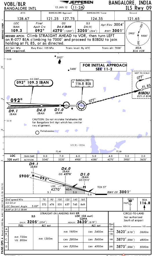
In class today we are talking about transition altitude where you input standard pressure into your altimeter etc. In the US that altitude is obviously FL180. But the question is where do you find that altitude for other countries or oceanic? I asked that question and the instructors looks at me like I had a arm growing out of my forehead. Any input would be most appreciated.

")