More GPS Approach and KASE Approach

Bman.

New Member
More GPS and KASE Approach Questions

Afternoon folks-

I am back with some more questions. Again, I am nothing but a wanna be.. I only fly on the simulator so I will preface my questions with that. Here goes:

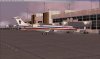
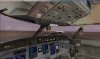
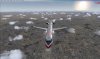
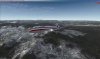
I flew from KDEN to KASE last night in a CRJ-700. It was a quick hop but I ran into several things that left me wondering. If you have the time pull up a few charts and let me know what you think-
  • KASE airport diagram lists on the front page "stage" aircraft. What is that and how do I know what stage my aircraft is? As noted above I was in a CRJ-700 so the whole approach into KSAE seemed a little sketchy. What "stage" is the CRJ? The runway length was in check, the wingspan was under the max. allowed so it seemed to work ok.
  • I flew the VOR DME or GPS-C approach via DBL transition. All worked out well but I was told by tower to land (circle-to) rwy 33. I thought well, maybe I should find a rwy 33 approach to simply things into the airport. No such luck - there are no specific approaches in to 33. My question is - how come? Noise control?
  • Departure from rwy 15 is not allowed (per the KASE airport chart). How come there is enough room to drop down right downwind leg and base but not enough room to takeoff in that direction.
  • The section profile for the GPS-C approach is stepped. How am I suppose to do these steps if the aircraft has no VNAV? Do I stick fly and adhere to the steps by staring at the altimeter?
  • On the GPS-C approach chart all of the approaches listed on the section view are "circle to land" - how come the runway which apparently gets most of the landing traffic doesn't have vasi when rwy 15 does? The real question from this point is why does rwy 15 have MIRL/MALSF and PAPI when there are no approaches to this runway?
  • DH - Decision Height : why do I need to dial this in on the MDF? What does it do for me? Call out minimums when landing?
That's it for now guys. Look forward to a response. Obviously I have no idea what I am doing here. Simulator or not - ha.

Benjamin
 
Re: More GPS and KASE Approach Questions

KASE airport diagram lists on the front page "stage" aircraft.

The airport page on the NACO charts doesn't show this, but stage probably refers to the sound signature of the aircraft. Your operations manual would probably tell what stage your aircraft qualified for.

I should find a rwy 33 approach to simply things into the airport. No such luck - there are no specific approaches in to 33. My question is - how come? Noise control?

Terrain.

Departure from rwy 15 is not allowed (per the KASE airport chart).

Terrain. And it most likely only refers to IFR departures, not VFR.

How am I suppose to do these steps if the aircraft has no VNAV? Do I stick fly and adhere to the steps by staring at the altimeter?

Yes.

how come the runway which apparently gets most of the landing traffic doesn't have vasi when rwy 15 does?

A VASI/PAPI provides a certain amount of terrain clearance that varies with distance from the runway, up to 4nm/4sm. If the appropriate amount of terrain clearance is not available, no VASI/PAPI can be provided.

The real question from this point is why does rwy 15 have MIRL/MALSF and PAPI when there are no approaches to this runway?

The MIRL applies to the whole runway, not just 15. And all approaches essentially go to this runway; they're labeled circling approaches only because the descent gradient in the final approach segment exceeds 400 ft/nm.

DH - Decision Height : why do I need to dial this in on the MDF? What does it do for me? Call out minimums when landing

I don't know.
 
Taylor-

Thanks for the reply. You win the prize I guess. I had been checking my post all day to see if there was a response. Here it is! Yahoo.

1) You are right, not NACO but Jeppesen, I am using SimCharts 4.0. It calls out all sort of stuff on the airport chart.

2) Yes, I figured it might be a terrain conflict. However, it's interesting that they would allow for a downwind / and base leg pattern at the terrain conflicting end end yet not let you take off in that direction. I guess my perception is skewed since the performance profile of the CRJ ascends more quickly than other planes.

On second though, I imagine you would fly right over the airport if you approached for the more mountainous side as there wouldn't be reception for any navigation until you were right over the airfield - in essence sending you back out to a point near the DBL any way.

3) Lights - interesting. You would think there would be better lights on the main approach runway. I guess they are expecting the pilot to exercise caution and not mtn. fly in the dark or bad conditions.

4) I see about the circle-to-land. You need that extra distance to scrub speed off.

I don't see how this approach could be done in any plane at night. Seems there would be no way to see the tops of mountains when you are circling down to land.

Thanks again for the help. I am sure to make new questions tonight on the next journey. I would post an FSX screen shot but you real jockies may ban me from the forum. If any one is interested I will put a few up.

Benjamin
 
The VOR/GPS-C approach isn't really used by airliners anymore; a Special LOC 15 approach was established a few years back in the aftermath of the G-III crash.
 
Interesting Aloft-

"On March 21, 2001, a flight inspection crew from the FAA's Oklahoma City, Oklahoma, Flight Inspection Field Office performed a commissioning flight check at ASE to support a proposed GPS standard instrument approach procedure to runway 15. After the inspection, the flight inspection crew noted, on the procedural control form, that circling should not be allowed at night30 because areas of unlighted terrain conflicted with traffic patterns and circling descent maneuvers near the airport. Afterward, the flight inspection crew provided its comments to FAA staff at the National Flight Procedures Office in Oklahoma City."

I just read the report.

Tell me about circle to land some more. Circle to land doesn't necessary "circle" to land. These guys were coming straight in from DBL to rwy 15. There was no circle to land. Is the FAA just referring to all approaches at night - they must be straight in?

http://www.myairplane.com/databases/approach/pdfs/05889LDE.PDF

What happens if landing is on 33 - you must circle to land in the daytime?

Benjamin
 
not let you take off in that direction.
For IFR departures, the FAA assumes a relatively poor amount of performance. Plus, you have no course guidance when taking off...and you can't see anything, in theory, because you're in the clouds. For pattern operations, you're in visual conditions and you're descending, which is easier than climbing.

Lights - interesting. You would think there would be better lights on the main approach runway. I guess they are expecting the pilot to exercise caution and not mtn. fly in the dark or bad conditions.
Why do you think 33 is the main approach runway?

I see about the circle-to-land. You need that extra distance to scrub speed off.
Not sure what you mean by that. The minimums are high on the approach and the missed approach is far from the runway in order to take into account how shallowly the airplane will climb if you go missed. If it took you lower or closer to the runway, if you went missed, you wouldn't clear terrain. You probably can't descend any earlier due to terrain.

You shouldn't have any extra airspeed to bleed off by the time you reach the FAF, I would think. The difficulty is getting rid of altitude.

I don't see how this approach could be done in any plane at night. Seems there would be no way to see the tops of mountains when you are circling down to land.
In theory, you don't need to, because you should remain within the approved circling area. I seem to recall this approach was N/A at night, anyway.
 
I figured it was the main approach since takeoff from 15 is not permitted. If you can't takeoff and there are fairly high percentages of missed approaches on rwy 15, it would make sense that landing rwy 33 is the preferred less risk option. I am sure it's more about prevailing winds.

Sorry about the "circle to land". I am confused.

You wrote..."they're labeled circling approaches only because the descent gradient in the final approach segment exceeds 400 ft/nm."...

I meant to say the circling was there to drop the altitude (not speed).
I suppose I am confused because the GPS-C approach doesn't indicate and "straight in" MDA.

Yes, you are correct - night = N/A. The new approach localizer is not implemented in FSX (using an older navaid database from 2004 I think). That would be part of my issue. I don't see the approved circling area.

Any way you slice it - it's a nasty approach in my book. Given the potential Wx conditions and terrain issues to contend with it can get ugly quickly.

Benjamin
 
YI meant to say the circling was there to drop the altitude (not speed). I suppose I am confused because the GPS-C approach doesn't indicate and "straight in" MDA.

Circling-only approaches are not desirable. No one designs them intentionally. They design the best approach they can, based on a set of approach design criteria, and if the MDA ends up being too high, they are not permitted to label the approach with a runway number. It's just a "heads up" to the pilot.

If the aircraft is able to descend rapidly enough to an appropriate altitude, the aircraft can certainly land straight-in. I expect that this happens most of the time, wind permitting.
 
Re: More GPS and KASE Approach Questions

Sorry, missed this the first time:
  • The section profile for the GPS-C approach is stepped. How am I suppose to do these steps if the aircraft has no VNAV? Do I stick fly and adhere to the steps by staring at the altimeter?
Staring at the altimeter?!?!


1362599_02bcdea730.jpg


:D
 
Re: More GPS and KASE Approach Questions

Great. Now I have spat-out Franziskaner Hefe all over my monitor.

Oh, the huge manatee... I love it! Very Pilot602 of ya! ;)
 
... I would post an FSX screen shot but you real jockies may ban me from the forum. If any one is interested I will put a few up.

Benjamin
I'll dig around tomorrow for some pics and show you what the actual approach looks like. Yes, it can get very interesting in that box canyon. Just to answer one of your questions...land on 15, depart on 33, if at all possible. I won't tell you how a circle to land 33 looks from the real airplane...but there's a reason you don't want to do it in a jet!!! Enough said!!:panic:

The crash you referred to I believe they tried circling at night with a left hand pattern (read: to the right and ended in cumulogranite).

Also, you must have special training (read a Gulfstream crew, most likely with all the FLIR, etc. they have) to land there at night.
 
Ha - yeah, cola out the nose. Ok, maybe stare is not the correct word. However, with no copilot on board, there is way to much to do to read the chart, analyze the steps and monitor time, altitude and distance.

I did a circle to land on rwy 33. Since I am seeing giant manatees here are a few SS from my approach. Laugh if you want - still fun nonetheless.


I made it on piece - but it would scared the masses.

Thanks Guys-

Benjamin
 

Attachments

  • Flight Simulator FSX Screenshots - 50431.jpg
    Flight Simulator FSX Screenshots - 50431.jpg
    37.9 KB · Views: 186
  • Flight Simulator FSX Screenshots - 50437.jpg
    Flight Simulator FSX Screenshots - 50437.jpg
    50.4 KB · Views: 154
  • Flight Simulator FSX Screenshots - 50443.jpg
    Flight Simulator FSX Screenshots - 50443.jpg
    56 KB · Views: 176
  • Flight Simulator FSX Screenshots - 50446.jpg
    Flight Simulator FSX Screenshots - 50446.jpg
    36.9 KB · Views: 172
  • Flight Simulator FSX Screenshots - 50451.jpg
    Flight Simulator FSX Screenshots - 50451.jpg
    56.9 KB · Views: 163
  • Flight Simulator FSX Screenshots - 50453.jpg
    Flight Simulator FSX Screenshots - 50453.jpg
    54 KB · Views: 168
  • Flight Simulator FSX Screenshots - 50457.jpg
    Flight Simulator FSX Screenshots - 50457.jpg
    31.5 KB · Views: 149
  • Flight Simulator FSX Screenshots - 50461.jpg
    Flight Simulator FSX Screenshots - 50461.jpg
    30.5 KB · Views: 172
  • Flight Simulator FSX Screenshots - 50464.jpg
    Flight Simulator FSX Screenshots - 50464.jpg
    46.7 KB · Views: 175
  • Flight Simulator FSX Screenshots - 50466.jpg
    Flight Simulator FSX Screenshots - 50466.jpg
    40.5 KB · Views: 166
I may be wrong, but it seems to me that the original poster is unclear as to the purpose of any "circle to land" clearance.

"circle to land" is used when conditions favor landing on a runway that is different than the one to which you are performing an instrument approach. there are many possible reasons for this: equipment failure, winds, runway grade, etc.

In this case it appears that only 15 has an approach, and if, for example, the winds were strong and from the north then 33 would be the best choice.

"circle to land" shouldn't actually be a circle, but as close to a normal traffic pattern as you can perform given the weather conditions, while not loosing sight of the runway.
 
Sundog -

You are right! I am confused. This is what I know. GPS-C does not have an indicated rwy on the approach plate is the heading is not in line with rwy 15..or any runway for that matter.

The only MDA information is listed for a "circle to land" - there is no straight in approach.

ATC called out "cleared circle to Land rwy 33. Enter right downwind traffic"...or something similar to that. So, in short I had to make a 180 turn on the boxed in end of run way 33.

Regarding circle to land, I have only read that you have to have the runway in sight at all times during your turns. Why it's called a circle to land when I really only need to do a downwind traffic pattern is my confusion. As noted in posts above, they call it circle to land since approach is steep.

Tell me more !

Thanks again guys

Benjamin
 
the approach in question for those following the thread: http://naco.faa.gov/d-tpp/0801/05889VDGC.PDF
and yes, this approach is not aligned with a runway, so it is a circling approach and only has circling minimums.

i can't help you with the actual ATC transmission, since it was only simulated. you mentioned it did tell you "enter right downwind"

overall, i'd suggest that simulating an CRJ into Aspen probably isn't the best way to teach yourself instrument flying.
 
I agree - not the best approach to learn from.
I spend a lot of time in the Mooney bravo and Cessna rest assured. This was, as always, just for fun to see what I could do. Every time I try to fly by the books, I have more questions.

Aloft - yup, I have bought the hard copy version to study. That's next on my agenda. Currently I have been reading Miscrosoft FSX for Pilot Real World Training. It has more information than a typical simmer would want and need (700 pages) but it covers about 1/10th of all real world knowledge - at best. It seems there is no end to what you could or need to know.

There are no straight-in minimums. You can make a straight-in approach - I wasn't aware of this. Why wouldn't they post minimums for a straight in approach? On the Jep chart I have it say N/A. I didn't know that meant - come on down.

Benjamin
 
Back
Top