meritflyer
Well-Known Member
What does the "Z" mean in this title -
RNAV (GPS) Z RWY 17
RNAV (GPS) Z RWY 17
What does the "Z" mean in this title -
RNAV (GPS) Z RWY 17
...also, as the designators move backward, the minimums raise. ie- Z will have lower min's than Y
Some of us can't even do that.The standard that the GPS unit providers has to go by only allows for one procedure per type (ie RNAV, ILS, NDB) to loaded for each runway
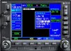
Unless you have a newer GPS/FMS (and I don't think even some of the recent ones will do it either), check that procedure you load up, the one in your unit may not be the plate you are looking at. The providers (Collins, Universal, Garmin, etc) typically only put the more precise approach in, so the LPV only RNAV may be the procedure in the database and you may be only able to shoot the LNAV only version of the approach. Double check those waypoints.
The standard that the GPS unit providers has to go by only allows for one procedure per type (ie RNAV, ILS, NDB) to loaded for each runway, IIRC. Thus the X Y and Z labels as A B and C are typically for circling approaches.
"Jeppesen recently began delivering Multiple Approach Indicator Procedures to our customers. A Multiple Approach Indicator Procedure is one which has a special designator such as a Y or Z in the approach title; for example, RNAV (GPS) Z Rwy 22. However, not all avionics equipment is able to accept these added procedures..."
Sooo, I am not sure what you two are trying to say. My statement is simply that the standard seems to be evolving or not being adhered to and that you could very well find yourself with a database that has an approach you cannot do, even though you have the plate, nothing more than a heads up, take an extra second and verify you are shooting the approach you think you are.
Then again, we're allowed to build our own approaches too.
But I am fully, 100%, plus, plus in agreement of verifying the approach after it's loaded.
:beer:
How do you build an RNAV IAP and get approach mode to activate?
Polar
I've seen the authorizations to do it, never operated with it, but could explain how and what is involved with "building your own approach"?