C150J
Well-Known Member
Hi guys,
Just trying to get a discussion going concerning IFR in mountainous regions. First and foremost, I would like all of us to take off our "135/121/91/91.X Fractional" hats and just think about actual terrain clearance. Consider us /G, so don't worry too much about identifying intersections, either. I will try to ask the question in its simplest form.
Here's you're departure field:
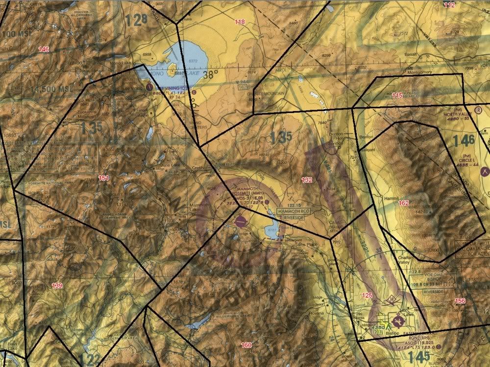
KMMH
Mammoth Yosemite
http://skyvector.com/airport/MMH/Mammoth-Yosemite-Airport
ODP - http://naco.faa.gov/d-tpp/0910/SW2TO.PDF
Say it's IMC with 600 overcast. You're going to SFO, so you're planning on V381 - NIKOL - V244 (don't worry about the rest of the routing). You follow the ODP:
MAMMOTH LAKES, CA
MAMMOTH YOSEMITE TAKE-OFF MINIMUMS: Rwy 9, 500-2 or std. with a min.
climb of 400'per NM to 10700. Rwy27, 5000-5 or std.
with a min. climb of 450' per NM to 11800. DEPARTURE PROCEDURE: Rwy 9, climbing left turn heading 050° to intercept BIH R-307. Rwy 27, climbing
right turn to heading 095° to intercept BIH R-307. All aircraft proceed via BIH R-307 to BIH VOR/DME, then via BIH R-322 (V381) to NIKOL Int then via assigned route.
In a non-radar environment, how do you ensure terrain clearance? For those that have operated in and out of MMH and other mountainous airports, how low are the MVAs? Can a radar facility "see" you running down the valley? I realize that there is a minimum climb gradient (400-450 up to 10,700/11,800), but unlike a lot of "flatter" airports, these gradients don't get you above surrounding terrain, nor the MEAs in the area.
I apologize if this is a dumb question. I'm just trying to bolster my knowledge of mountainous and non-radar IFR ops.
Just trying to get a discussion going concerning IFR in mountainous regions. First and foremost, I would like all of us to take off our "135/121/91/91.X Fractional" hats and just think about actual terrain clearance. Consider us /G, so don't worry too much about identifying intersections, either. I will try to ask the question in its simplest form.
Here's you're departure field:
KMMH
Mammoth Yosemite
http://skyvector.com/airport/MMH/Mammoth-Yosemite-Airport
ODP - http://naco.faa.gov/d-tpp/0910/SW2TO.PDF
Say it's IMC with 600 overcast. You're going to SFO, so you're planning on V381 - NIKOL - V244 (don't worry about the rest of the routing). You follow the ODP:
MAMMOTH LAKES, CA
MAMMOTH YOSEMITE TAKE-OFF MINIMUMS: Rwy 9, 500-2 or std. with a min.
climb of 400'per NM to 10700. Rwy27, 5000-5 or std.
with a min. climb of 450' per NM to 11800. DEPARTURE PROCEDURE: Rwy 9, climbing left turn heading 050° to intercept BIH R-307. Rwy 27, climbing
right turn to heading 095° to intercept BIH R-307. All aircraft proceed via BIH R-307 to BIH VOR/DME, then via BIH R-322 (V381) to NIKOL Int then via assigned route.
In a non-radar environment, how do you ensure terrain clearance? For those that have operated in and out of MMH and other mountainous airports, how low are the MVAs? Can a radar facility "see" you running down the valley? I realize that there is a minimum climb gradient (400-450 up to 10,700/11,800), but unlike a lot of "flatter" airports, these gradients don't get you above surrounding terrain, nor the MEAs in the area.
I apologize if this is a dumb question. I'm just trying to bolster my knowledge of mountainous and non-radar IFR ops.
")