casey
Well-Known Member
As a (very) few people know, I have taken a leave from the 121 world to go back to school and collect a Meteorology degree. I spent 4 weeks in mid-May to mid-June with the Vortex 2 Field Project chasing severe storms.
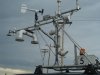
I drove a mobile mesonet vehicle which collects surface thermodynamic data. My probe's mission was to try to stay in front of the storms mesocyclone and drive from the inflow through the gust front into the precipitation core (aka lots of hail) and then turn around and drive back across the gust front and into the inflow. Sounds easy but was consistently complicated by fast storm motion and horrible road networks (wet dirt, especially clay type dirt can be quite slippery).
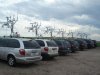
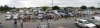
Overall there were ~50 vehicles and in addition to the mobile mesonets there were camera phootogrammertry teams; various mobile radars (including some fancy phased array dual polarization equipment) to collect dual doppler data at storm scale down to tornado scale; sticknets for more thermodynamic data; disdrometers to collect microphysical data (drop size distributions, etc); tornado pods to put into the path of tornados; balloon launch teams to take soundings to asses the environment around the storm; and a UAV to collect thermo data above the surface in the vicinity of the storm (only able to operate in a limited area due to FAA restrictions).
It was a lot of fun and we drove through a lot of weather we wouldn't normally drive through. We saw a little bit of large hail and our vehicle's top wind gust was 84 mph taken near a landspout in TX.
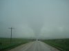
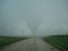
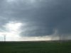
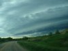
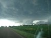
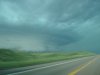
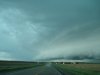
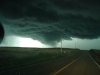
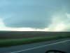
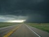
Attached are some pictures from the project, though they dont really capture what we were seeing.
I drove a mobile mesonet vehicle which collects surface thermodynamic data. My probe's mission was to try to stay in front of the storms mesocyclone and drive from the inflow through the gust front into the precipitation core (aka lots of hail) and then turn around and drive back across the gust front and into the inflow. Sounds easy but was consistently complicated by fast storm motion and horrible road networks (wet dirt, especially clay type dirt can be quite slippery).
Overall there were ~50 vehicles and in addition to the mobile mesonets there were camera phootogrammertry teams; various mobile radars (including some fancy phased array dual polarization equipment) to collect dual doppler data at storm scale down to tornado scale; sticknets for more thermodynamic data; disdrometers to collect microphysical data (drop size distributions, etc); tornado pods to put into the path of tornados; balloon launch teams to take soundings to asses the environment around the storm; and a UAV to collect thermo data above the surface in the vicinity of the storm (only able to operate in a limited area due to FAA restrictions).
It was a lot of fun and we drove through a lot of weather we wouldn't normally drive through. We saw a little bit of large hail and our vehicle's top wind gust was 84 mph taken near a landspout in TX.
Attached are some pictures from the project, though they dont really capture what we were seeing.
Attachments
-
 V2_MQ1.jpg110.7 KB · Views: 102
-
 V2_MQ2.jpg71.8 KB · Views: 101
-
 V2_MQ3.jpg66.2 KB · Views: 108
-
 V2_MQ4.jpg78.3 KB · Views: 106
-
 V2_MQ5.jpg84.7 KB · Views: 112
-
 V2_MQ6.jpg91 KB · Views: 109
-
 V2_MQ7.jpg93.5 KB · Views: 115
-
 V2_MQ8.jpg58.5 KB · Views: 110
-
 V2_MQ9.jpg77.7 KB · Views: 107
-
 V2_MQ12.jpg100.6 KB · Views: 122