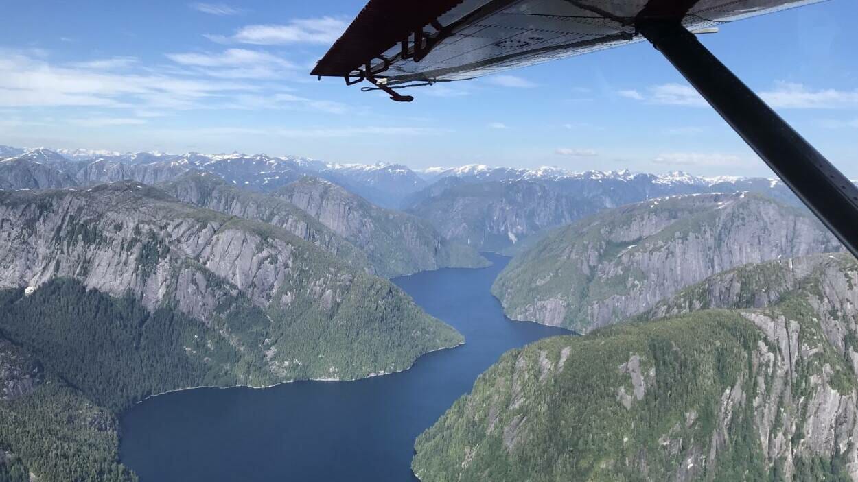
DeHavilland Beaver missing Ketchikan

I spent a year flying in Alaska one week. There's nothing to compare it to.

Economics and egos lead to some puzzling decision-making. Snowmobile batteries, in Alaska, have the same priority as transplant organs, in the lower 48.

There was no question, I didn't think I could cut it up there. I don't think I had enough misplaced confidence or skill to make anybody any money.
 
I have a Chelton system in my plane and absolutely love it. The sim I use for recurrent has a G600 with a 750/530 installed and I've yet to find anything that system does that my 20+ year old DOS based Chelton doesn't do just as well. Pretty amazing tech considering when it came out.
The terrain presentation on the ND is still the best terrain depiction out there.
 
Inaccurate Wx reporting seems to be endemic. It’s like FSS or whoever doesn’t want to deal with the hassle of IFR or they think they are doing everyone a favor by reporting better than actual conditions or delaying updating the wx to IFR. I always make a point to check the wx cams before I depart so I know what I’m about to get myself into.

is it known that wx was reporting VFR when it was IFR? Even if so, the pilot still has a responsibility, regardless of whatever the Wx report is saying, to evaluate conditions as he encounters them or of what’s ahead of him. And make decisions accordingly. If he’s trying to stay VFR/VMC, is expecting VFR, but is seeing IMC ahead, nothing is forcing him to continue into it…..except for him.

Each region really is like it’s own state with often vastly different Wx patterns. I’ve gotten fairly comfortable where I’m at in SW but if I had to go up to the Slope, SE AK, or somewhere else I’d be like a fish out of water.

Changing from SW flying to operating in a Korean winter days later of LIFR and freezing conditions and snow, was a definite change of pace.
 
It's ego.
I'm and Alaskan Bush Pilot!! I can do ANYTHIN- *CRUNCH*

And synthetic vision is to HELP get you OUT of inadvertent IMC, not INTO it.

And it's not just weather. Weather occurs and changes everywhere. Alaska is not special.

It's the macho culture, and it will happen again.
 
is it known that wx was reporting VFR when it was IFR? Even if so, the pilot still has a responsibility, regardless of whatever the Wx report is saying, to evaluate conditions as he encounters them or of what’s ahead of him. And make decisions accordingly. If he’s trying to stay VFR/VMC, is expecting VFR, but is seeing IMC ahead, nothing is forcing him to continue into it…..except for him.


Changing from SW flying to operating in a Korean winter days later of LIFR and freezing conditions and snow, was a definite change of pace.
This was the next day, weather is reporting VFR. The day before looked much like the second two pictures when the beaver left KTN.

Very common in KTN to see 3 miles, 300 sct, 1000 ovc, 2400 RVR being reported and actual conditions are 2400RVR and 300 OVC.
ae730583376160c58f5e031801ec9dca.jpg
ba50ef570ac6eb6563b60b2be8cf9bad.jpg
4f3efba197c980bc6b76c3f83dd00305.jpg
 
From the. 2015 Promech crash…


"Promech and at least one other operator that was willing to take more weather-related risks were both able to fly more revenue passengers than two other more conservative operators who cancelled flights that day," the NTSB said in a statement on the findings Tuesday.
 
Inaccurate Wx reporting seems to be endemic. It’s like FSS or whoever doesn’t want to deal with the hassle of IFR or they think they are doing everyone a favor by reporting better than actual conditions or delaying updating the wx to IFR. I always make a point to check the wx cams before I depart so I know what I’m about to get myself into.


Each region really is like it’s own state with often vastly different Wx patterns. I’ve gotten fairly comfortable where I’m at in SW but if I had to go up to the Slope, SE AK, or somewhere else I’d be like a fish out of water.

I don’t come on here much anymore, but having flown everywhere up here except the northwest Arctic coast this is accurate.

it’s all very very different from place to place and where pretty much everywhere in the lower 48 is “more or less the same” in terms of how you handle the basics, local knowledge is one of the most important things up here.

I can’t say I’m surprised by this accident but I’m never surprised anymore.
 
Is this the system you guys are talking about?


It is but that’s not a good representation of the moving map functionality. It looks like they’ve either got terrain turned off or zoomed out so far it’s been decluttered.
This is what it looks like in practice.
DD7FB2D6-5BCE-4489-A8B5-A1BE6B4E0292.jpeg
4BCFCEB0-B744-4234-A145-BF5C7A22C225.jpeg

these are screen grabs reconstructed from a display unit in an accident aircraft.

Notice the bottom picture (first chronologically) has highlighted yellow the terrain that is giving a “caution terrain” warning. It also has a “noodle” coming from the aircraft symbol, in this case showing that if the aircraft maintains the turn it will miss the offending piece of terrain.

In the top picture, the later one, there is now a pull up warning and a bit of red highlights the relevant terrain. The airplane has stopped its turn and is headed straight for the terrain so the noodle has gone away.

Outside of the terrain warning, the orange/brown terrain is at or above aircraft altitude, and green is aircraft altitude to 2500’ (IIRC) below. There’s another color, grayish green, for terrain more than 2500’ below.

This combination of features with intuitive color coding for relative altitude, highlighting threatening terrain, and the “noodle” for maneuvering flight, is not something I’ve seen equaled elsewhere and it’s what made Chelton ideal for the flying we did IMHO

Another thing to note, in the “newer” GPWS systems I’ve flown, when you inhibit terrain warning audio you also get rid of any visual warnings (or in some cases, any terrain display at all [looking at you, Honeywell]) the Chelton that isn’t the case, you can inhibit the audio, but IIRC you still got the pop up message on the PFD and the yellow/red highlights on the moving map, which would also auto-center and zoom to 1 mile range. Something to keep in mind for some of those accidents (Air excursions, Wings of Alaska, couple of Promech wrecks) where the NTSB makes a big deal about the terrain warnings being inhibited
 
Last edited:
is it known that wx was reporting VFR when it was IFR? Even if so, the pilot still has a responsibility, regardless of whatever the Wx report is saying, to evaluate conditions as he encounters them or of what’s ahead of him. And make decisions accordingly. If he’s trying to stay VFR/VMC, is expecting VFR, but is seeing IMC ahead, nothing is forcing him to continue into it…..except for him

maybe.

it changes fast, so fast, in south east in particular

I’ve left on flights where it was pretty good - 2000’ ceilings,4 or 5 miles and stable weather for days no forecast changes, etc,flown for a half hour and had nowhere to go that was VFR faster than I could turn around.

the last 4 or 5 years the forecast models have gotten A lot better, that’s helped but there’s still gaps and they get it wrong, and depending on where you are it’s very easy to leave in VFR and have IFR conditions catch you without warning. This is no problem in an IFR airplane,it’s a different story in other equipment. Add in flat light, or when I was flying on the slope white out and you’ve got a very different environment than most places in the lower 48.

It’s more than just hubris that’s killing people, it’s a really complicated place to fly.
 
It is but that’s not a good representation of the moving map functionality. It looks like they’ve either got terrain turned off or zoomed out so far it’s been decluttered.
This is what it looks like in practice. View attachment 60315View attachment 60316
these are screen grabs reconstructed from a display unit in an accident aircraft. Notice the bottom picture (first chronologically) has highlighted yellow the terrain that is giving a “caution terrain” warning. It also has a “noodle” coming from the aircraft symbol, in this case showing that if the aircraft maintains the turn it will miss the offending piece of terrain. In the top picture, the later one, there is now a pull up warning and a bit of red highlights the relevant terrain. The airplane has stopped its turn and is headed straight for the terrain so the noodle has gone away. Outside of the terrain warning, the orange/brown terrain is at or above aircraft altitude, and green is aircraft altitude to 2500’ (IIRC) below. There’s another color, grayish green, for terrain more than 2500’ below.

00M?
 
This was the next day, weather is reporting VFR. The day before looked much like the second two pictures when the beaver left KTN.

Very common in KTN to see 3 miles, 300 sct, 1000 ovc, 2400 RVR being reported and actual conditions are 2400RVR and 300 OVC.
ae730583376160c58f5e031801ec9dca.jpg
ba50ef570ac6eb6563b60b2be8cf9bad.jpg
4f3efba197c980bc6b76c3f83dd00305.jpg

With my whoppin 10 hours actual IFR and needing to get IPC current again.....this looks like a scud runners delight or a pilot with some mad IFR skillzzz. Yeah , I guess there guys and gals that can come up with some creative risk management and bust into this. Right now, I am the faint o heart and I wonder about the others with high time that would settle in on a day like this with a cold one or a martini?
 
I spent a year flying in Alaska one week. There's nothing to compare it to.

Economics and egos lead to some puzzling decision-making. Snowmobile batteries, in Alaska, have the same priority as transplant organs, in the lower 48.

There was no question, I didn't think I could cut it up there. I don't think I had enough misplaced confidence or skill to make anybody any money.
Hearts? Lungs? Sick babies? Batteries??

Even snow-machine Batteries????

Delivery of Pepsi...or Coke (depending on the village) kills more pilots and Pax in Alaska than any other mission.

This one sounds more like Tourists.

Sucks to kill Tourists. Unlike Natives, Tourists are litigious effers with estates and executors and lawyers and whatnot.

BTW, I'd reckon you've got plenty of confidence. Just not enough -as the literary folks speak of- ability to "suspend disbelief".
 
Last edited:
From the. 2015 Promech crash…


"Promech and at least one other operator that was willing to take more weather-related risks were both able to fly more revenue passengers than two other more conservative operators who cancelled flights that day," the NTSB said in a statement on the findings Tuesday.
That report was also unique in that it singled out the DO amd CP specifically as causal factors. Going through the entire docket was much more informative than the actual report as to what was really going on.
 
I think so yeah. The Wings crash would have looked almost identical but I don’t think the feds did screen reconstructions just some data plots.
They released a video:


The accident pilot signed up to fly right seat in caravans in the L48. Nice, funny, but low time and inexperienced. Was put through ground in the L48, then sent to Juneau because "A pilot is a pilot," according to K5 management. "There's nothing special about Alaska flying."

Some background: The accident pilot finished IOE two weeks before the crash during a windy, but fairly dry, spring (Read: Nice weather). Had turned around several times due to wx in the previous week, and canceled a few flights. The winter before the crash, K5 management got rid of Wings' local dispatch office, told the Alaska crew that we didn't know what we were talking about, and accused us of trying to "sabotage" the operation. Wings Dispatchers in AK would change, upgrade, downgrade flights, and kept newer pilots on a relatively tight leash, working with pilots to help them make weather decisions based on local weather knowledge, weather cams, forecasts, and so on.

K5 "Dispatchers" would simply read the METAR at the origination and destination airports, as if it mattered. The departure and destination airports were both "VFR."

During the post-accident investigation, the company tried to throw the pilot under the bus, and partially succeeded. But the NTSB did sniff out "Operational control" as a big part of the problem, though they focused on the stupid flight risk assessment forms (Which, for the record, I fully support. But we'd often have fifteen minute quick turns all day long, and we weren't supposed to delay a flight to do them. And they were extremely permissive, relative to some of the FRA forms from other Alaska 135 operators I've seen.)

I wasn't at work that day, but if I had been, I wouldn't have been flying, no matter what a flight risk assessment form said.

Airplanes were dispatched as if they were IFR capable in a pinch ("You've got a GPS!"), when it came to weather, but VFR ("We're a VFR operation!") when it came to maintenance requirements, as per @Roger Roger above. The Chelton EFIS is a great piece of equipment, but ours, especially on the 207s, were fairly unreliable due to K5's behavior surrounding avionics maintenance. (The planes were in great shape, mechanically, IMO, but avionics mx is a different skillset)

Juneau has a culture problem; K5 management just added idiocy and hubris.

IMG_0673.JPG
 
Back
Top