You are using an out of date browser. It may not display this or other websites correctly.
You should upgrade or use an alternative browser.
You should upgrade or use an alternative browser.
daily pic
- Thread starter gne in prog
- Start date
A
Adler
Guest

A
Adler
Guest
I've got a lot of learning to do, but I'm really enjoying Lightroom

lr31apilot
Well-Known Member
He already has the bug... poor kid

A
Adler
Guest
Adler It's taken me over a year and half to REALLY be able to maximize Lightroom. I'm having to go back and re-edit all of my old stuff. Exposure, and fill light are your friends. It will give you more even lighting vs the brightness tab.
I've got a few hours under my belt...just when I was starting to get a hang of Photoshop.
I've got a few hours under my belt...just when I was starting to get a hang of Photoshop.
They're both great programs with different applications. All the pro guys that I've met, whether they shoot fashion, aviation, horses, nature and wild animals, food, nightlife, or bands all use Lightroom. It seems to bring images to life more so than PS. There are some great books out on it.
scooter2525
Very well Member

A
Adler
Guest

Fantastic. Did you manipulate the clarity, or add a vignette?
A
Adler
Guest
Fantastic. Did you manipulate the clarity, or add a vignette?
yes, yes, and yes
Attachments


rframe
pǝʇɹǝʌuı
Found some older pics, dont think I ever posted these but might have. This was a ferry trip from California to Idaho a couple years ago.
Diablos

The Bay's headwaters.

Mt Shasta

8,000' high mountain lake

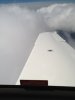
Baby volcano.

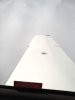
On Top.

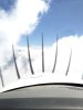
Playing with the F-15's at Kingsley.

Klamath Lake

Cascades.

Columbia River wind mill farm.

Diablos
The Bay's headwaters.
Mt Shasta
8,000' high mountain lake
Baby volcano.
On Top.
Playing with the F-15's at Kingsley.
Klamath Lake
Cascades.
Columbia River wind mill farm.
rframe
pǝʇɹǝʌuı
Now this looks like a fun mountain strip. Found this one two nights ago flying around in some Idaho back country. This guy bought a couple hundred acres of old mining claims and had a cabin back in there for many years (I know because we used to hunt a few miles south of there until the wolves killed off all the elk in that area). As we flew over it looks like he just bulldozed the airstrip within he past couple years. There's a big X on it and it's not charted. I didn't get a picture of it so I found it on Google earth. Best measurements I could get from Google rulers show it to be about 900' long and better than 6% grade with a ramp off the bottom end, elevation is 4,400'.


A
Adler
Guest

A
Adler
Guest

Murdoughnut
Well sized member
Lightroom is the sheeeeet. I get a faculty discount on all Adobe products which is nice. Instead of paying a photographer when my twins arrived, I invested in a backdrop kit and was able to take some great shots aided by Lightroom.

