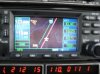
156kts GS in a 172 and PA and NJ XC pictures

Matt13C

Well-Known Member
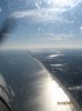
I have been flying some XC the last few weekends to get up to the 50 hours for the IR ride. The first few are from a trip from TTN to ACY. I flew straight east then south along the coast. It was my girlfriends first flight in a small plane so I wanted to make it enjoyable.

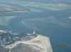
1.Just turned south, over Belmar, NJ.
2. Barnegat Lighthouse
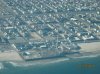
3. Seaside Pier
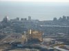
4. Atlantic City in the distance.
5.Borgota in ACY.
6. Final 31. There was also a Coast guard Helicopter in the pattern, sorry for making you extend your downwind!
7. Shadow in the pines on departure.
 

Attachments

  • Beach flying.jpg
    Beach flying.jpg
    145.4 KB · Views: 209
  • Barnegat lighthouse 1.jpg
    Barnegat lighthouse 1.jpg
    143.6 KB · Views: 206
  • Seaside.jpg
    Seaside.jpg
    249.4 KB · Views: 222
  • NJ Coast.jpg
    NJ Coast.jpg
    111.1 KB · Views: 179
  • Borgota.jpg
    Borgota.jpg
    163.1 KB · Views: 237
  • Straight in 31.jpg
    Straight in 31.jpg
    98.7 KB · Views: 231
  • Shadow.jpg
    Shadow.jpg
    248.4 KB · Views: 225
Cool!

I was just up in a 172 with my girlfriend last night, and we also hit 156kts (at 3000 feet) over the ground going to Chicago. 90 kts on the way home though...
 
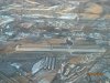
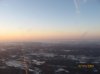
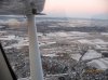
These are from a trip from TTN-LNS (Lancaster, PA). They have a nice little restaurant with a good view of the runways if you get a window seat. We left a bit later than anticipated and I ended up staring straight into the sun the whole way out. The flight itself was great, very calm evening and we got to see a good amount of traffic being on the edge of Philly airspace. Had a Southwest 1000 feet above me and regional jet pop out of the sun 500 feet almost directly over me. Approach called the traffic out well ahead, but it still was a bit startling seeing a jet that close just pop out of the sun.

1. Southwest 1000-1500 above and North of us.
2. Staring into the sun.
3. Pottstown-Limerick airport. Just west is 3-mile island, the cooling stacks give a very good indication of what to expect on landing.
4. Partially snow covered fields.
 

Attachments

  • Southwest 1500 above.jpg
    Southwest 1500 above.jpg
    12.4 KB · Views: 131
  • Blinding.jpg
    Blinding.jpg
    132.5 KB · Views: 139
  • Pottstown 3.jpg
    Pottstown 3.jpg
    250.1 KB · Views: 156
  • North.jpg
    North.jpg
    110 KB · Views: 137
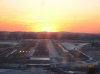
1. Long final 26 LNS at sunset.
2. Short final, sun ducking behind a mountain.
3.Departing LNS, making the turn eastbound.
 

Attachments

  • LNS at sunset.jpg
    LNS at sunset.jpg
    98.8 KB · Views: 124
  • Final 26 LNS at sunset.jpg
    Final 26 LNS at sunset.jpg
    110.5 KB · Views: 139
  • Departing LNS.jpg
    Departing LNS.jpg
    219.9 KB · Views: 130
156 is nice. It sure beats my -8 yesterday doing slow flight in the 172.

Nice! :rawk:

I wanted to see how slow I could get it going on the way out. But with the amount of traffic Philly was routing over me and it being my GF's second time in a small plane, I chose to keep it straight and level ha.
 
Nice! :rawk:

I wanted to see how slow I could get it going on the way out. But with the amount of traffic Philly was routing over me and it being my GF's second time in a small plane, I chose to keep it straight and level ha.

We managed to get the indicated airspeed down to 25 kts doing a power off stall before it finally broke. That was...fun
 
Seeing the GPS flip around when you start going backwards is pretty funny. =]

In the Cessna 140, you stall at "zero" and can actually maintain MCA at zero, the actual break takes even more AoA, its a weird feeling.
 
no pics as proof but on the way home from Austin (KAUS to KTKI) I was gettin 130 ground speed in a 152 :rawk:

I was sorta afraid the wings would fall off though... :sarcasm: :laff:
 
1. Southwest 1000-1500 above and North of us.
2. Staring into the sun.
3. Pottstown-Limerick airport. Just west is 3-mile island, the cooling stacks give a very good indication of what to expect on landing.
4. Partially snow covered fields.

All the way West to Harrisburg ;)
 
All the way West to Harrisburg ;)

Crap! I guess I should have done some research before I posted the name/pic. I showed someone the picture while telling them where we went and they said "oh, that is 3 mile island". Having no ability to tell one cooling stack from the next and not knowing the exact location, believed them.

Sorry, not 3 mile island. Actually Limerick power station.
 
That is what I am wondering. SInce when PTW move to west of MDT. That would make my regular MDT to PHL really, really short. ;)
 
Highest grou speed for me to date in a 172 was 199kts (just coulden't get her to 200) on the way to ELP from IWA. On the way back thoug, we were averaging in the 50's. 2+ there 5+ back. Almost had to stop for fuel.
 
Back
Top