Flight_Watch
New Member
Anyone have an experience using the Garmin 96C for general aviation? I just picked myself up one and it is amazing how much info it contains. Of course GPS is no substitute for a good understanding of basic navigation. Anyway, it contains an updateable Jepp database and obstacle warnings.
Do most people use external antennas for these handhelds or do they work well enough under the plane's metal roof? It also came with a Yoke clip, which I haven't tried out yet.
Here are my thoughts so far:
Pros:
I know exactly how many miles I am out from any given airport.
List the closest airports at all time incase of an emergency landing is required.
Warns you before you enter controlled airspace.
Contains tower, ground frequencies for all airports.
VNav. but don't know how to use it yet.
Easy to use weight and balance feature
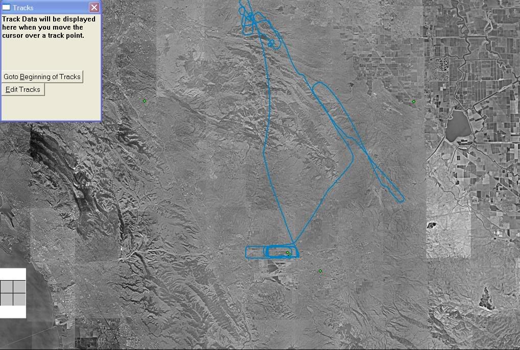
Records all flights including max speed, distance, landings, etc
Accuracy within 16 ft. and 40 hr. battery life
Good backup incase there is an electrical failure onboard
Cons:
Another instrument that takes your eyes away from traffic spotting
Must pay to upload the latest Jepp database
Kind of expensive but at least it is portable
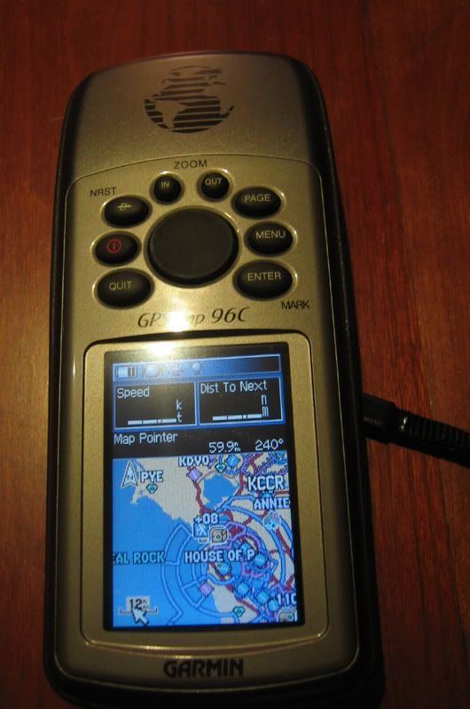
Do most people use external antennas for these handhelds or do they work well enough under the plane's metal roof? It also came with a Yoke clip, which I haven't tried out yet.
Here are my thoughts so far:
Pros:
I know exactly how many miles I am out from any given airport.
List the closest airports at all time incase of an emergency landing is required.
Warns you before you enter controlled airspace.
Contains tower, ground frequencies for all airports.
VNav. but don't know how to use it yet.
Easy to use weight and balance feature
Records all flights including max speed, distance, landings, etc
Accuracy within 16 ft. and 40 hr. battery life
Good backup incase there is an electrical failure onboard
Cons:
Another instrument that takes your eyes away from traffic spotting
Must pay to upload the latest Jepp database
Kind of expensive but at least it is portable